Mountain bike route "Around the Habichtspiel"


- 3:00 h
- 15.68 km
- 425 m
- 270 m
- 359 m
- 598 m
- 239 m
- Start: The starting point is the MTB parking lot "Roter Stollen", alternatively, you can also begin from the hiking parking lot "Firnsbachtal".
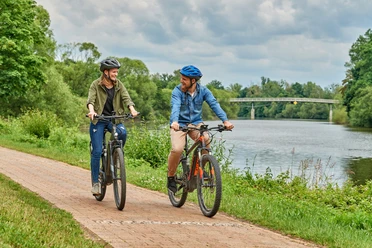
You can start the approximately 16 km long route from two different starting points. The route includes both asphalted and unpaved paths with various inclines and descents. The circular course will automatically lead you back to your starting point.
This MTB circular route was established by the Zweckverband Naturpark Habichtswald in cooperation with Hessen-Forst. The route passes through state forests in the southern Habichtswald and, outside the forest, through the territory of the municipality of Schauenburg.
Good to know
Pavements
Unknown (100%)
Best to visit
suitable
Depends on weather
Directions
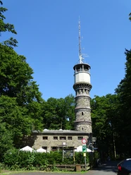
Directions from the "Roter Stollen" nature park parking lot are as follows The 16 km long circular route starts at the Naturpark-Parkplatz "Roter Stollen" with an ascending trail section, passing through the recognizable infrastructure of the former military area before entering an old beech forest. At the end of this path, the trail transitions into another downhill trail section, leading to the edge of the forest. From there, the route follows an asphalted section along the A44, reaching the settlement "Firnsbachtal," which offers a place to stop and rest. Close to the settlement, the route leaves the road and crosses the Firnsbach stream on another trail. Below the nature reserve "Hirzstein," a steady ascent begins on a gravel track. Passing through the "Kaffeemühle," you reach the Porta Lapidaria, from where a short detour to the Bismarckturm is worthwhile, offering a magnificent view over Kassel. Continuing through the impressive rock formation of the Bielsteinklippen, the path moderately ascends. After passing through diverse forest landscapes, you pass by the golf course and enjoy several beautiful views of the Herkules, the landmark of the UNESCO World Heritage site Bergpark Wilhelmshöhe, before reaching the "Roter Stollen" parking lot again.
Route markings
 Signpost "Main route"
  Signpost "Dangerous spot"
  Signpost "Wanderweg quert"
 Tour information
Loop Road
Directions & Parking facilities
Getting there
By bike: Take Ehlener Straße from Habichtswald or Kassel to the parking lots Roter Stollen or Hohes Gras. From there, you can access the trails. By car: Take Ehlener Straße from Habichtswald or Kassel to the MTB parking lot Roter Stollen (signposted TrailPark/MTB-Lift). By public transport: Take bus line 22 to the Hohes Gras stop (hourly service to and from Kassel).
Author
Naturpark Habichtswald
Organization
License (master data)
Naturpark Habichtswald

Safety guidelines
Usage is at your own risk! Whenever possible, ride in a group and avoid riding alone! Helmet usage is mandatory! Additional protective gear is strongly recommended!
Social Media
Nearby

Download GPX file