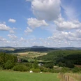
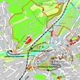
The tour starts clockwise at the hiking portal of the Panoramapfads, which is located on the barbecue area of Hatzfeld. On a forest path we go slightly uphill through the forest with stately beech trees around the "Pracht", a 542 m high mountain peak. At a crossroads north of the mountain stock stands the “Erinnerungseiche”, a stately tree with a plaque attached to it on which the memory conceived by the Transport and Beautification Association can be read. Downhill you continue towards the hamlet of Ebenfeld and to the Schäferhof. You cross the hollow between Pracht and the Ringelsberg and after a stretch through a piece of forest you reach a hut with rest and again a wonderful panoramic view. From here the tour leads partly on a path, then on a forest path, uphill, accompanied by many views to the "Alte Wegkreuz". The information point “Crossroads” describes the meeting of old and modern road connections. Through mixed forest with larches, beech, spruce and also oaks, mixed with old and new clearings, it goes downhill again, up to an old giant hute oak, which creates a striking transition to an open area. From there, you hike along a path and through a light oak grove to the “Hardt”, a viewpoint of exceptional quality. From the Rothaargebirge in the west to the Sackpfeife to the Holzhäuser Klippen in the east, the view goes. From there the trail runs continuously downhill, first with an unobstructed view of the opposite mountain range with the bagpipe in the background and then turns into a relatively slope-parallel forest path. After a valley cut you reach a clearing with a view of the city of Hatzfeld and the Emmaus Chapel on the opposite slope. The Emmaus Chapel is a late Romanesque pillar basilica from the 12th century, with the Rindt organ built in 1706, one of the oldest playable organs in Northern Hesse. Now it goes uphill again to Hatzfeld Castle, where you can visit the area of the castle ruins. The 13th century. Hatzfeld Castle was the ancestral castle of the Lords of Hatzfeld. In the disputes with the Marburg Landgraves, these were usually on the side of the Archdiocese of Mainz, whose Landvogt resided in Amöneburg. The Hatzfelds were also active followers at Mellnau Castle as castle men. After the extinction of the Hatzfeld-Hatzfeld line in 1570, the property passed from one train to the Hessian Landgraves. The castle began at the beginning of the 16th century. In 1842 parts were laid down by order of the Grand Duchy of Hesse-Darmstadt. In recent years, the Association for Burg- und Heimatkunde Hatzfeld has gradually renovated parts of the castle. The castle complex is still owned by the family of Hatzfeld. A short but worthwhile detour leads to the viewpoint Panoramablick, from which once again a magnificent view is offered. When you leave the area, you will immerse yourself in a historical form of forest use, the Scheitelwald. The cuttings of the hornbeam were used to obtain fodder and bedding for the animals kept in the city, mostly goats. The lighting of the trees also encouraged the growth of grass, which could be used for grazing. The trail now leads slightly uphill and you circle the old town of Hatzfeld below us on forest paths and paths. You walk along the edge of the forest, then you cross the valley again, this time in the direction of the splendour, up to the edge of the forest - a final vantage point with a magnificent view of the Ederbergland, an ascent that has once again been worthwhile. In descending stages you will come back to the starting point of the hike.


